3D printing technology has received widespread attention in recent years. At present, 3D printing technology has made significant progress in various fields, but 3D printing technology has not been fully applied. In the field of geospatial information, initial applications are only available in individual sectors.
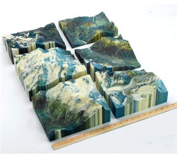
Application of 3D printing technology in the field of geoscience information
(1) Making various 3D solid models based on geographic information data
3D printing technology can accurately distinguish land, water, buildings and other topographical features, especially copying a complex scaled natural topographic structure or urban structure, which makes the application of 3D printing technology in the field of geoscience information technology gradually increase. For large-area geographs, the geographic model can be segmented, printed block by block, and finally stitched together. Apply 3D printing technology to print geographic information data into a variety of physical models:
1. Geological model: The auxiliary engineering personnel understand the attribute characteristics, ore body characteristics, groundwater profile and aquifer structure at different depths in different horizontal and vertical directions.
2. Topographical model: Improved the efficiency of negotiating complex solutions.
3. Geographic Information System Model: Quickly and high-quality representation of rural, urban, and topographic maps.
4. Real estate 3D sand table model: not only the appearance is fine and accurate, but the internal structure also conforms to the standard scale.
(2) Technical difficulties in rendering GIS layers using 3D printing technology
The technology of presenting GIS data through 3D printing technology is still in its infancy, and there are certain technical problems, including:
1. Need to convert a large number of different kinds of geospatial data formats into STL file format.
2. Reduce data loss during the conversion of DEM data to STL file format. The STL format file is one of several file formats recognized by current 3D printers. Researchers are acquiring data in 3D STL format in several stages using a variety of software and methods. One of the successful ones is to convert DEM ASCII XYZ directly into 3D STL data.
3.3D printing technology is not an inexpensive technical means in nature, so when making physical 3D physical models, it is necessary to estimate the amount of printed materials used.
4.3D printing technology can produce high-precision, high-resolution solid models, but at the same time it may lose some of the details. During the model printing process, the width of the material layer stack determines the resolution of the print and the minimum thickness limit of the model wall.
5. The user needs to prepare the 3D digital model in advance for 3D print data input.
6. After the original GIS data is printed into a 3D model, the attributes of the data are integrated and compressed. But sometimes researchers need to study the individual properties of the data and need to go back to the flat map -- refer to the initial plane shape.
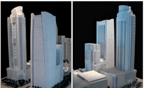
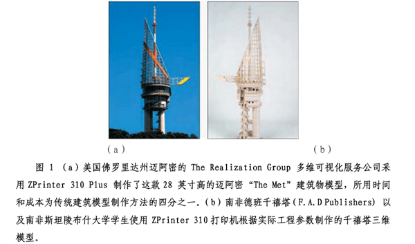
(3) The connection between 3D printing technology and virtual 3D city model (CityGML)
The visualization process of spatial data has gone through a series of development stages. At first, only 2D paper maps can be applied to display two-dimensional representations of real-life things in a fixed-scale, non-interactive static mode. With the advent of information technology, these 2D maps can be scanned into computers to generate non-interactive digital 2D images that can be scaled as needed, and the virtual world scale concept became a technical challenge at the time. With the advent of geospatial information technology, interactive 2D data with corresponding non-spatial attributes is generated. The further development of GIS technology successfully created interactive 3D data and virtual models with corresponding attributes. Then, the 3D modeling function ushered in a series of rapid advancements and technological innovations. Based on this, the concept of 3D simulation roaming was proposed, and related software was used to generate dynamic video. Then, with the advancement of hardware, the advent of 3D printers has greatly shortened the generation time of 3D physical models, making the target object making process impossible before.
CityGML is a format for data exchange and storage of virtual 3D city models and is an OGC accredited standard for Open Geospatial Information Alliance. Compared to other 3D vector formats, CityGML is a general-purpose topology model that expresses the real world. For specific domains, CityGML can also provide extension mechanisms to enrich data with recognition capabilities while preserving semantic interoperability. The target application areas include urban and landscape planning, architectural design, tourism and leisure activities, and three-dimensional cadastral maps. Five continuous resolution levels (LOD0-LOD4) can be used, with print accuracy ranging from ≤0.2 m to ≤5 m. . At this stage, many cities have established 3D urban models based on CityGML, such as Berlin in Germany and Apeldoorn in the Netherlands.
The development trend of 3D printing technology in the field of geospatial information
At present, the application of 3D printing technology in the field of geospatial information mainly develops in three new directions:
1. The real estate 3D sand table model generated by 3D printing technology not only has detailed appearance details, high resolution, but also the internal structure conforms to the standard scale, which greatly enhances the reference value of planning and design. With the increasing public opinion about the 3D printing industry policy in China, the real estate field will make new progress in the application of 3D printing technology to the standardization of display to consumers and planners. The relevant person in charge of the Ministry of Science and Technology has indicated that it will Formulate relevant 3D printing industry specifications and related policies.
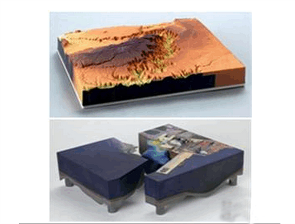

The 2.3D geological sand table also contributes to the understanding of geological data integration such as building foundations, underground space structures, and tunnels. The 3D printing technology can be used to quickly generate 3D geological mineral models to help geological and mine developers understand the geological ore body conditions. 3D printing technology has been practiced in the geoscience research field of some developed countries. There are many mature applications in the visualization of underground oil and gas fields, geological research, field environment analysis, mineral resources and energy mining, and military command.
3. Geospatial information science research requires a 3D model with higher three-dimensional fineness. At present, the world's most popular professional 3D printer is the Zprinter series. This type of printer is well compatible with the output of geospatial information models and supports full-color printing, so that the three-dimensional physical characteristics of the geological structure can be clearly and meticulously displayed. It is very efficient. The world-renowned commercial architecture design company Jerde's efficiency in the “Zlote Tarasy†project in Warsaw, Poland, and the “Morongo Casino Dazzling Canopy†in California were “exponentially†improved. MIT also applies Z Corp. 3D printers to teaching and research. It not only enhances the benefits of the student's educational experience, but also completes cutting-edge courses in related fields such as architectural design, and strengthens close ties with the world's top research institutions and key laboratories. Some domestic surveying and mapping equipment companies are also actively supporting the domestic 3D printing technology with hardware, software technology and accurate mapping data, which can clearly print high-standard models.
3D printing technology is regarded as the most popular development direction in the field of geoscience information technology. The UK Terrainator.com Maps Platform is a website that prints 3D map craft products. Users can circle the map according to a certain scale in the map provided by the website and submit it to the map platform. The system will automatically generate a three-dimensional topographic map. The website prints a three-dimensional terrain model for the user based on the area of ​​the area, the complexity of the terrain, and some customized requirements. Currently, the map platform only supports parts of the United States, Western Canada, the United Kingdom, and parts of Europe. In addition, the US website Landprint.com is a company that sells 3D geographic models and terrain models with a clear price tag. It sells three types of 3D models such as the Hawaiian Islands, world famous mountains, famous national parks and lunar craters. The 3D terrain model of Helens Volcano can be sold for $195. Similarly, the company also offers 3D terrain customization services to meet the specific needs of customers. 3D printing technology has become more and more widely used in the field of geoscience information, and its technology has been improved day by day. It will play an important role in the 3D simulation of geological survey and the output of 3D model results of geological exploration.
Height Adjustable Standing Desks
If you want to work in a healthy way at home, the most important thing is Sit Stand Desk . Other ordinary Office Desk are not suitable for long-term work. A Height Adjustable Desk needs to be able to adjust the height of the desk, or more other changes. You can choose whether to work sitting or standing. The space of each family is different, so we provide many different sizes and types of Adjustable Standing Desk, Let every customer have a suitable solution to create their own healthy office environment. Our Height Adjustable Table is designed and developed by professional R & D personnel, and the height adjustment range is researched. The most suitable height range is selected to meet the users of different heights, which greatly improves the utilization rate of Electric Desk.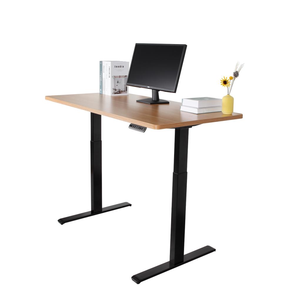
Height Adjustable Standing Desks,Steady Height Adjustable Sit Stand Desk,2-Leg Height Adjustable Desk,Computer Height Adjustable Desk
Suzhou CHEX Intelligent Technology Co., Ltd. , https://www.qxhdesk.com